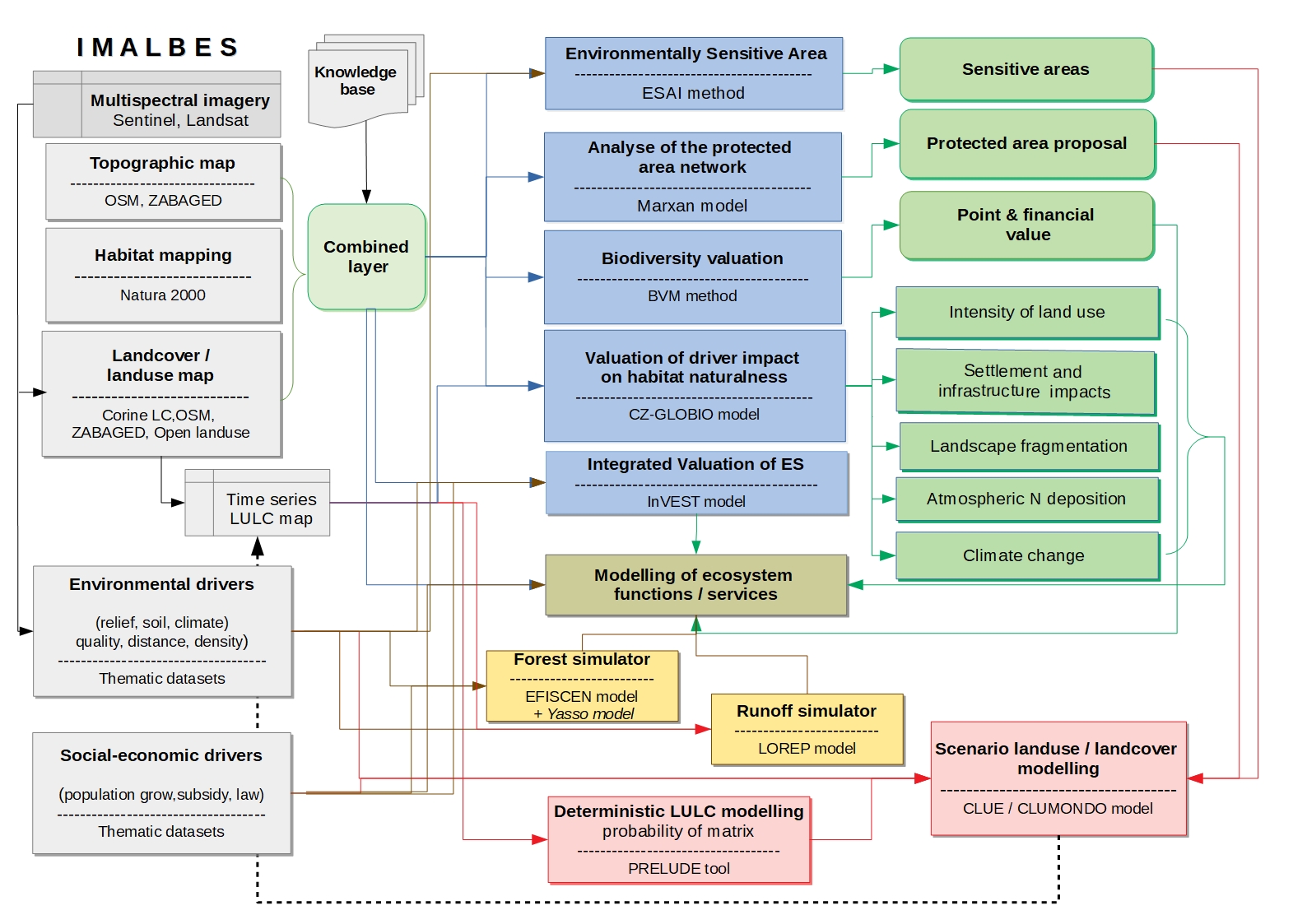
The main objective of our project IMALBES, integrating selected models of climate and land use change, ecosystem function performance and biodiversity development, adapted for the conditions of the Czech Republic, is to be able to monitor and predict biodiversity lost and changes in ecosystem functioning in cultural forest-agricultural landscape.
Multisources habitat maps of the Czech Republic (Corine LC – 1:100 000, Combined Layer – 1:10 000 mixed with 1:100 000, Consolidated Layer – 1:10000), used for national, regional and local studies, linked-up to knowledge base containing fragmentation geometry, naturalness, habitat biodiversity value, carbon supply, evapotranspiration capacity etc. Unfortunately, only Corine LC layers enable to compare land use/land cover (LUC) categories in time and to model LUC development in the future.
Integration of biodiversity (BD) and ecosystem service (ES) provision is performed by the assessment (Habitat Valuation Method; Seják and Cudlín 2010) and modelling of BD (CR GLOBIO; Cudlín et al. 2017) and selected ES (e.g. carbon sequestration, temperature regulation) using the unified matrix and linked-up knowledge base (Seják et al. 2012, Pechanec et al. 2018) . The outputs of one model (e.g. CZ Globio for estimation of biodiversity status and endangerment) can be used as inputs to another model (e.g. Marxan for selection of valuable habitats for protection).
Our integrated approach allows the complex view and parallel valuation of several ecosystem functions.
